Geolocate

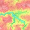
Plougras topographic map

Click on the map to display elevation.

About this map

Name: Plougras topographic map, elevation, terrain.

Location: Plougras, Lannion, Côtes-d'Armor, Brittany, Metropolitan France, 22780, France (48.46265 -3.60832 48.54342 -3.52353)

Average elevation: 225 m

Minimum elevation: 111 m

Maximum elevation: 314 m

Other topographic maps

Click on a map to view its topography, its elevation and its terrain.
Ploumanac'h

France > Brittany > Côtes-d'Armor

Average elevation: 10 m

Lannion

France > Brittany > Côtes-d'Armor > Lannion > Lannion

Average elevation: 72 m

Penker

France > Brittany > Côtes-d'Armor > Louannec

Average elevation: 44 m

La Croix de Bois

France > Brittany > Côtes-d'Armor > Boqueho

Average elevation: 190 m

La Buglais

France > Brittany > Côtes-d'Armor > Lancieux

Average elevation: 8 m

La Menardais

France > Brittany > Côtes-d'Armor > Taden

Average elevation: 55 m

Pont Auffret

France > Brittany > Côtes-d'Armor > Rostrenen

Average elevation: 196 m

Rumoyec

France > Brittany > Côtes-d'Armor > Plusquellec

Average elevation: 162 m

Gear up for your next adventure:

🔦LED Headtorch - Bright and durable light for night activities
🥾Mountaineering Boots - Supportive boots for climbing and high-altitude hiking
🔪Outdoor Multitool - Versatile tool for repairs and food prep in the wild
🧥Waterproof Jacket - Lightweight rain jackets for hiking and outdoor activities
👖Convertible Hiking Pants - Zip-off legs to adapt to changing weather conditions

As an Amazon Associate, this site earns from qualifying purchases at no extra cost to you.