Geolocate

Fillmore topographic map

Click on the map to display elevation.

About this map

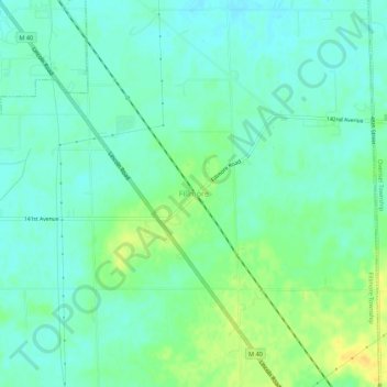
Name: Fillmore topographic map, elevation, terrain.

Location: Fillmore, Fillmore Township, Allegan County, Michigan, United States (42.70114 -86.06143 42.74114 -86.02143)

Average elevation: 211 m

Minimum elevation: 202 m

Maximum elevation: 228 m

Other topographic maps

Click on a map to view its topography, its elevation and its terrain.

Watson

United States > Michigan > Allegan County

Average elevation: 242 m

Indian Lake

United States > Michigan > Allegan County

Average elevation: 249 m

Dorr Township

United States > Michigan > Allegan County

Average elevation: 224 m

Salem Township

United States > Michigan > Allegan County

Average elevation: 209 m

Martin

United States > Michigan > Allegan County

Average elevation: 253 m

Wayland

United States > Michigan > Allegan County

Average elevation: 233 m

Fennville

United States > Michigan > Allegan County

Average elevation: 204 m

Otsego

United States > Michigan > Allegan County

Average elevation: 222 m

Hopkins

United States > Michigan > Allegan County

Average elevation: 216 m

Miner Lake

United States > Michigan > Allegan County

Average elevation: 222 m

Gear up for your next adventure:

🥾Durable Hiking Shoes - Long-lasting shoes for frequent hiking
🛌Insulated Sleeping Pad - Critical thermal barrier between you and the cold ground
🧴Sunscreen SPF - Broad-spectrum sunscreen for outdoor activities
🧣Evaporative Cooling Towel - Beat the heat during intense summer climbs
💧Hydration Pack - Hands-free hydration system for long hikes

As an Amazon Associate, this site earns from qualifying purchases at no extra cost to you.