
Make a donation
Gear up for your next adventure:
As an Amazon Associate, this site earns from qualifying purchases at no extra cost to you.
Kollegal topographic map
Click on the map to display elevation.
Make a donation
Gear up for your next adventure:
As an Amazon Associate, this site earns from qualifying purchases at no extra cost to you.
Kollegal
Kollegal is located at 12°09′N 77°07′E / 12.15°N 77.12°E / 12.15; 77.12. It has an average elevation of 588 m (1,929 ft). Since the town is on the foothills of the Western Ghats, it is home to a mixed topography. Temperature is moderate.
Make a donation
Gear up for your next adventure:
As an Amazon Associate, this site earns from qualifying purchases at no extra cost to you.
About this map
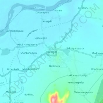
Name: Kollegal topographic map, elevation, terrain.
Average elevation: 645 m
Minimum elevation: 625 m
Maximum elevation: 901 m
Make a donation
Gear up for your next adventure:
As an Amazon Associate, this site earns from qualifying purchases at no extra cost to you.