Geolocate

Topping topographic map

Click on the map to display elevation.

About this map

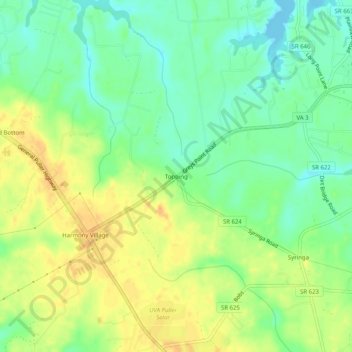
Name: Topping topographic map, elevation, terrain.

Location: Topping, Middlesex County, Virginia, 23169, United States (37.56819 -76.49439 37.60819 -76.45439)

Average elevation: 16 m

Minimum elevation: -3 m

Maximum elevation: 33 m

Other topographic maps

Click on a map to view its topography, its elevation and its terrain.

Urbanna

United States > Virginia > Middlesex County

Average elevation: 8 m

Gear up for your next adventure:

🛰️Satellite Messenger - Emergency communication for areas with no cell service
📷Outdoor Action Camera - Capture high-elevation views and rugged adventures
🧢Sun Protection Cap - Breathable cap to protect from sun exposure
🔋Solar Power Bank - Keep your GPS and devices charged during long outdoor trips
🥾Mountaineering Boots - Supportive boots for climbing and high-altitude hiking

As an Amazon Associate, this site earns from qualifying purchases at no extra cost to you.