
Thank you for supporting this site ❤️
Make a donation
Make a donation
Gear up for your next adventure:
As an Amazon Associate, this site earns from qualifying purchases at no extra cost to you.
Bexbach topographic map
Click on the map to display elevation.
Thank you for supporting this site ❤️
Make a donation
Make a donation
Gear up for your next adventure:
As an Amazon Associate, this site earns from qualifying purchases at no extra cost to you.
About this map
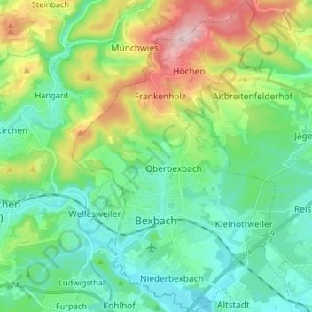
Name: Bexbach topographic map, elevation, terrain.
Location: Bexbach, Saarpfalz-Kreis, Saarland, 66450, Germany (49.32191 7.21954 49.40788 7.30567)
Average elevation: 308 m
Minimum elevation: 225 m
Maximum elevation: 517 m
Thank you for supporting this site ❤️
Make a donation
Make a donation
Gear up for your next adventure:
As an Amazon Associate, this site earns from qualifying purchases at no extra cost to you.