Geolocate

Pitugo topographic map

Click on the map to display elevation.

About this map

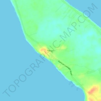
Name: Pitugo topographic map, elevation, terrain.

Location: Pitugo, Mati, Davao Oriental, Davao Region, 8200, Philippines (6.85990 126.26765 6.89990 126.30765)

Average elevation: 7 m

Minimum elevation: 0 m

Maximum elevation: 40 m

Other topographic maps

Click on a map to view its topography, its elevation and its terrain.

Mayo River

Philippines > Davao Oriental > Mati

Average elevation: 461 m

Gear up for your next adventure:

🛶Canoe Life Vest - Safety vest for water sports
🛶Waterproof Dry Bags - Keep electronics and clothes dry during river crossings
🧴Waterproofing Spray - Restore the DWR coating on jackets and tents
🏃Hydration Running Vest - Carry water and maps close to your body for speed
🥾Mountaineering Boots - Supportive boots for climbing and high-altitude hiking

As an Amazon Associate, this site earns from qualifying purchases at no extra cost to you.