
Ubbergen topographic map
Interactive map
Click on the map to display elevation.
About this map
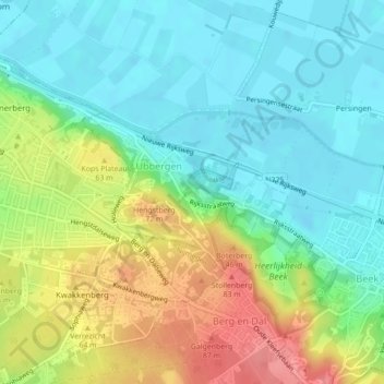
Name: Ubbergen topographic map, elevation, terrain.
Location: Ubbergen, Berg en Dal, Geldern, Niederlande (51.82935 5.89217 51.84057 5.91233)
Average elevation: 37 m
Minimum elevation: 7 m
Maximum elevation: 92 m