Geolocate

Murbad topographic map

Click on the map to display elevation.

About this map

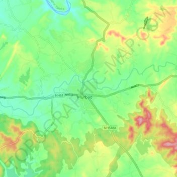
Name: Murbad topographic map, elevation, terrain.

Location: Murbad, Murbad Taluka, Thane District, Maharashtra, India (19.24773 73.34436 19.27501 73.44049)

Average elevation: 91 m

Minimum elevation: 28 m

Maximum elevation: 203 m

Gear up for your next adventure:

🧼Biodegradable Camp Soap - Environmentally friendly cleaning for gear and body
🪑Ultralight Camping Stool - Compact seating for rest stops during long hikes
🧢Outdoor Visor - Breathable visor for sunny hikes
🥾Hiking Boots - Sturdy boots providing ankle support and traction on rugged trails
🪑Insulated Seat Pad - Protect your seat from cold rocks and wet logs

As an Amazon Associate, this site earns from qualifying purchases at no extra cost to you.