
Thank you for supporting this site ❤️
Make a donation
Make a donation
Gear up for your next adventure:
As an Amazon Associate, this site earns from qualifying purchases at no extra cost to you.
Etiler Mahallesi topographic map
Click on the map to display elevation.
Thank you for supporting this site ❤️
Make a donation
Make a donation
Gear up for your next adventure:
As an Amazon Associate, this site earns from qualifying purchases at no extra cost to you.
About this map
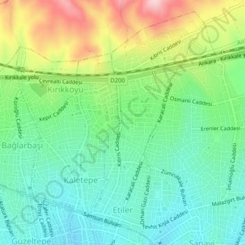
Name: Etiler Mahallesi topographic map, elevation, terrain.
Location: Etiler Mahallesi, Kırıkkale, Central Anatolia Region, Turkey (39.84650 33.51049 39.87101 33.52686)
Average elevation: 803 m
Minimum elevation: 724 m
Maximum elevation: 961 m
Thank you for supporting this site ❤️
Make a donation
Make a donation
Gear up for your next adventure:
As an Amazon Associate, this site earns from qualifying purchases at no extra cost to you.