Geolocate

Vaziani topographic map

Click on the map to display elevation.

About this map

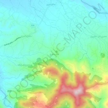
Name: Vaziani topographic map, elevation, terrain.

Location: Vaziani, Chokhatauri Municipality, Guria, Georgia (41.96455 42.22004 42.00455 42.26004)

Average elevation: 247 m

Minimum elevation: 136 m

Maximum elevation: 542 m

Gear up for your next adventure:

🧥Thermal Layer - Insulating layer for cold outdoor conditions
🥾Durable Hiking Shoes - Long-lasting shoes for frequent hiking
💧Hydration Pack - Hands-free hydration system for long hikes
💡Compact LED Flashlight - Powerful and portable flashlight for outdoor use
🧣Evaporative Cooling Towel - Beat the heat during intense summer climbs

As an Amazon Associate, this site earns from qualifying purchases at no extra cost to you.