
Thank you for supporting this site ❤️
Make a donation
Make a donation
Gear up for your next adventure:
As an Amazon Associate, this site earns from qualifying purchases at no extra cost to you.
Vesdre topographic map
Click on the map to display elevation.
Thank you for supporting this site ❤️
Make a donation
Make a donation
Gear up for your next adventure:
As an Amazon Associate, this site earns from qualifying purchases at no extra cost to you.
About this map
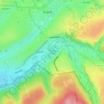
Name: Vesdre topographic map, elevation, terrain.
Location: Vesdre, Eupen, Verviers, Liège, Wallonie, 4700, Belgique (50.62005 6.03266 50.62025 6.03307)
Average elevation: 291 m
Minimum elevation: 240 m
Maximum elevation: 369 m
Thank you for supporting this site ❤️
Make a donation
Make a donation
Gear up for your next adventure:
As an Amazon Associate, this site earns from qualifying purchases at no extra cost to you.