Geolocate

Panunggangan topographic map

Click on the map to display elevation.

About this map

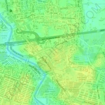
Name: Panunggangan topographic map, elevation, terrain.

Location: Panunggangan, Pinang, Tangerang, Banten, Java, Indonesia (-6.23044 106.62966 -6.22051 106.65063)

Average elevation: 23 m

Minimum elevation: 11 m

Maximum elevation: 29 m

Other topographic maps

Click on a map to view its topography, its elevation and its terrain.

Sukarasa

Indonesia > Banten > Tangerang

Average elevation: 15 m

Panunggangan Barat

Indonesia > Banten > Tangerang

Average elevation: 23 m

Batu Ceper

Indonesia > Banten > Tangerang

Average elevation: 19 m

Cendana Icon

Indonesia > Banten > Tangerang > Panunggangan Barat

Average elevation: 22 m

Gear up for your next adventure:

🚑Survival Whistle - Signal for help across long distances in mountains
🧣Evaporative Cooling Towel - Beat the heat during intense summer climbs
🛶Kayak Dry Bag - Waterproof storage for kayaking adventures
🥾Trail Hiking Socks - Comfortable socks to prevent blisters and fatigue
🚲Bike Repair Kit - Essential tools for on-trail mechanical issues

As an Amazon Associate, this site earns from qualifying purchases at no extra cost to you.