Geolocate

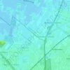
Utrecht topographic map

Click on the map to display elevation.

About this map
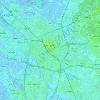
Name: Utrecht topographic map, elevation, terrain.

Location: Utrecht, Netherlands (52.02628 4.97010 52.14205 5.19516)

Average elevation: 3 m

Minimum elevation: -5 m

Maximum elevation: 19 m

Other topographic maps

Click on a map to view its topography, its elevation and its terrain.
Amersfoortse Berg

Netherlands > Utrecht > Amersfoort

Average elevation: 19 m

Breedeveen

Netherlands > Utrecht > Leersum

Average elevation: 15 m

Palestina

Netherlands > Utrecht > Amersfoort

Average elevation: 2 m

Cabauw

Netherlands > Utrecht

Average elevation: -1 m

Amerongse Berg

Netherlands > Utrecht > Amerongen

Average elevation: 34 m

Eembrugge

Netherlands > Utrecht > Baarn

Average elevation: 1 m

Gear up for your next adventure:

🛶Kayak Dry Bag - Waterproof storage for kayaking adventures
🦟Insect Repellent - Keep mosquitoes and black flies away in wooded areas
🚲Bike Repair Kit - Essential tools for on-trail mechanical issues
🚑Survival Whistle - Signal for help across long distances in mountains
⛺Camping Tent - Weather-resistant tents suitable for 2 to 6 people

As an Amazon Associate, this site earns from qualifying purchases at no extra cost to you.