Geolocate

Balsam Lake topographic map

Click on the map to display elevation.

About this map

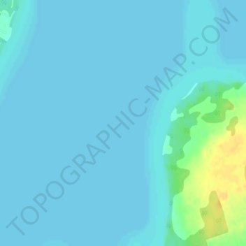
Name: Balsam Lake topographic map, elevation, terrain.

Location: Balsam Lake, Maple Avenue, Kawartha Lakes, Ontario, Canada (44.58405 -78.84599 44.58415 -78.84589)

Average elevation: 257 m

Minimum elevation: 253 m

Maximum elevation: 279 m

Ontario trails, hiking, mountain biking, running and outdoor activities

Other topographic maps

Click on a map to view its topography, its elevation and its terrain.

Sturgeon Lake

Canada > Ontario > Kawartha Lakes

Average elevation: 266 m

Pigeon River

Canada > Ontario > Kawartha Lakes > Omemee

Average elevation: 259 m

Dalrymple Lake

Canada > Ontario > Kawartha Lakes

Average elevation: 241 m

Head Lake

Canada > Ontario > Kawartha Lakes

Average elevation: 278 m

Emily Provincial Park

Canada > Ontario > Kawartha Lakes

Average elevation: 259 m

Young Lake

Canada > Ontario > Kawartha Lakes

Average elevation: 231 m

Four Mile Lake

Canada > Ontario > Kawartha Lakes

Average elevation: 282 m

Cameron Lake

Canada > Ontario > Kawartha Lakes > Fenelon Falls

Average elevation: 262 m

Victoria Lake

Canada > Ontario > Kawartha Lakes

Average elevation: 308 m

Gear up for your next adventure:

💧Hydration Bladder - Hands-free hydration solution for long treks
🥾Waterproof Hiking Boots - Boots keeping your feet dry in wet conditions
🧦Merino Wool Socks - Moisture-wicking comfort for long-distance hiking
🍽️Titanium Camping Spork - Ultralight and indestructible eating utensil
🧥Thermal Fleece Jacket - Versatile insulation for changing mountain temperatures

As an Amazon Associate, this site earns from qualifying purchases at no extra cost to you.