Geolocate

Vidor topographic map

Click on the map to display elevation.

About this map

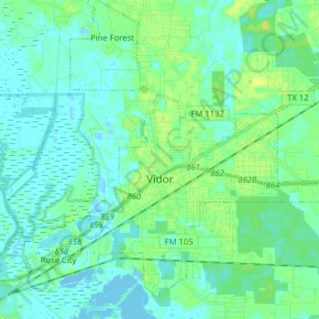
Name: Vidor topographic map, elevation, terrain.

Location: Vidor, Orange County, Texas, 77662, United States (30.08972 -94.03884 30.18653 -93.90830)

Average elevation: 5 m

Minimum elevation: -7 m

Maximum elevation: 14 m

Gear up for your next adventure:

🔨Vehicle Emergency Tool - Safety tool for remote road trips to trailheads
❄️Traction Ice Cleats - Slip-on spikes for icy trails and winter hiking
🦟Insect Repellent - Keep mosquitoes and black flies away in wooded areas
🥾Mountain Hiking Boots - High-traction boots for rocky terrain
🧥Waterproof Pants - Keep dry during rainy hiking conditions

As an Amazon Associate, this site earns from qualifying purchases at no extra cost to you.