
Les Sybelles topographic map
Click on the map to display elevation.
About this map
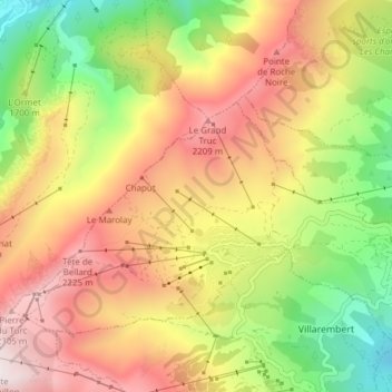
Name: Les Sybelles topographic map, elevation, terrain.
Average elevation: 1,732 m
Minimum elevation: 1,075 m
Maximum elevation: 2,390 m
Other topographic maps
Click on a map to view its topography, its elevation and its terrain.
La Toussuire
France > Auvergne-Rhône-Alpes > Savoy > Fontcouverte-la-Toussuire
Average elevation: 1,710 m
La Toussuire
France > Auvergne-Rhône-Alpes > Savoy > Fontcouverte-la-Toussuire
Average elevation: 1,710 m