Geolocate

Schafberg topographic map

Click on the map to display elevation.

About this map

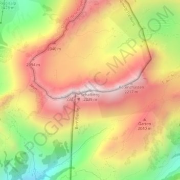
Name: Schafberg topographic map, elevation, terrain.

Location: Schafberg, Plaffeien, Sensebezirk, Fribourg, 1716, Switzerland (46.63697 7.31637 46.63707 7.31647)

Average elevation: 1,815 m

Minimum elevation: 1,316 m

Maximum elevation: 2,220 m

Gear up for your next adventure:

🧢Outdoor Cap - Protective cap for sun and rain during hikes
💡Compact LED Flashlight - Powerful and portable flashlight for outdoor use
🛌Down Sleeping Bag - Superior warmth-to-weight ratio for cold nights
🛌Insulated Sleeping Pad - Critical thermal barrier between you and the cold ground
💡LED Camping Lantern - Illuminate your campsite with long-lasting lanterns

As an Amazon Associate, this site earns from qualifying purchases at no extra cost to you.