
Thank you for supporting this site ❤️
Make a donation
Make a donation
Gear up for your next adventure:
As an Amazon Associate, this site earns from qualifying purchases at no extra cost to you.
Shallowater topographic map
Click on the map to display elevation.
Thank you for supporting this site ❤️
Make a donation
Make a donation
Gear up for your next adventure:
As an Amazon Associate, this site earns from qualifying purchases at no extra cost to you.
About this map
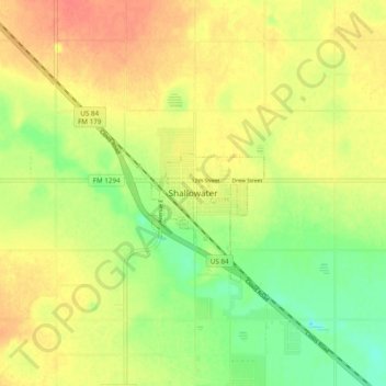
Name: Shallowater topographic map, elevation, terrain.
Location: Shallowater, Lubbock County, Texas, 79363, United States (33.65117 -102.03272 33.73117 -101.95272)
Average elevation: 1,009 m
Minimum elevation: 984 m
Maximum elevation: 1,028 m
Thank you for supporting this site ❤️
Make a donation
Make a donation
Gear up for your next adventure:
As an Amazon Associate, this site earns from qualifying purchases at no extra cost to you.