Geolocate

Orwell Village topographic map

Click on the map to display elevation.

About this map

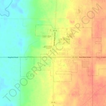
Name: Orwell Village topographic map, elevation, terrain.

Location: Orwell Village, Ashtabula County, Ohio, United States (41.52594 -80.88465 41.54732 -80.83116)

Average elevation: 264 m

Minimum elevation: 238 m

Maximum elevation: 291 m

Other topographic maps

Click on a map to view its topography, its elevation and its terrain.

Chapel

United States > Ohio > Ashtabula County

Average elevation: 258 m

Phelps Creek

United States > Ohio > Ashtabula County

Average elevation: 326 m

Pierpont

United States > Ohio > Ashtabula County

Average elevation: 305 m

Kingsville

United States > Ohio > Ashtabula County

Average elevation: 226 m

Gear up for your next adventure:

📷Outdoor Action Camera - Capture high-elevation views and rugged adventures
👟Trail Running Shoes - Agile footwear for fast-paced topographic exploration
🔦LED Flashlight - Powerful and long-lasting flashlight for camping and emergencies
🔦UV Flashlight - Detect minerals or specific insects in the dark
Family Camping Tent - Spacious tent suitable for family camping trips

As an Amazon Associate, this site earns from qualifying purchases at no extra cost to you.