Geolocate

Kinlochard topographic map

Click on the map to display elevation.

About this map

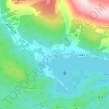
Name: Kinlochard topographic map, elevation, terrain.

Location: Kinlochard, Stirling, Scotland, FK8 3TW, United Kingdom (56.16767 -4.51321 56.20767 -4.47321)

Average elevation: 177 m

Minimum elevation: 26 m

Maximum elevation: 635 m

Gear up for your next adventure:

🧣Evaporative Cooling Towel - Beat the heat during intense summer climbs
🛶Kayak Accessories - Essential gear for safe and fun kayaking adventures
🔦LED Flashlight - Powerful and long-lasting flashlight for camping and emergencies
🔦LED Headtorch - Bright and durable light for night activities
🥾Waterproof Hiking Boots - Essential footwear for rugged terrain and wet Canadian trails

As an Amazon Associate, this site earns from qualifying purchases at no extra cost to you.