Geolocate

Benowo topographic map

Click on the map to display elevation.

About this map

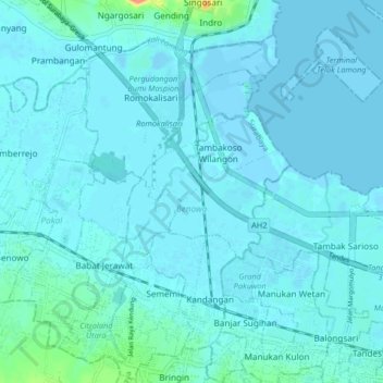
Name: Benowo topographic map, elevation, terrain.

Location: Benowo, Surabaya, East Java, Indonesia (-7.26558 112.62434 -7.18423 112.68993)

Average elevation: 5 m

Minimum elevation: -7 m

Maximum elevation: 60 m

Other topographic maps

Click on a map to view its topography, its elevation and its terrain.

Asemrowo

Indonesia > East Java > Surabaya

Average elevation: 4 m

Taman Prestasi

Indonesia > East Java > Surabaya > Ketabang

Average elevation: 6 m

Dukuh Pakis

Indonesia > East Java > Surabaya

Average elevation: 9 m

Dukuh Pakis

Indonesia > East Java > Surabaya

Average elevation: 15 m

Gear up for your next adventure:

🥾Mountain Hiking Shoes - Shoes with superior grip for mountainous terrain
🦯Trekking Poles - Reduced impact on joints for steep topographic climbs
👟Sport Hiking Sandals - Breathable footwear for water crossings and camp rest
🥾Hiking Gaiters - Protect legs and shoes from mud, snow, and debris
💧Hydration Pack - Hands-free hydration system for long hikes

As an Amazon Associate, this site earns from qualifying purchases at no extra cost to you.