
Make a donation
Gear up for your next adventure:
As an Amazon Associate, this site earns from qualifying purchases at no extra cost to you.
Haarrijnse Plas topographic map
Click on the map to display elevation.
Make a donation
Gear up for your next adventure:
As an Amazon Associate, this site earns from qualifying purchases at no extra cost to you.
About this map
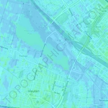
Name: Haarrijnse Plas topographic map, elevation, terrain.
Location: Haarrijnse Plas, Utrecht, Nederland (52.11239 5.01692 52.12078 5.02876)
Average elevation: 1 m
Minimum elevation: -5 m
Maximum elevation: 4 m
Make a donation
Gear up for your next adventure:
As an Amazon Associate, this site earns from qualifying purchases at no extra cost to you.
Other topographic maps
Click on a map to view its topography, its elevation and its terrain.
Oudegracht
Enkele gedeelten van de Oudegracht wijken af van het patroon met straten, werven en kelders. Dat geldt onder meer voor het gedeelte tussen de Gaardbrug en de Stadhuisbrug. Langs dit stukje gracht, dat tussen de oudste handelsnederzetting en het kerkelijke centrum rond de Dom doorliep, zijn andere oplossingen…
Average elevation: 6 m
Make a donation
Gear up for your next adventure:
As an Amazon Associate, this site earns from qualifying purchases at no extra cost to you.