Geolocate

Lapilang topographic map

Click on the map to display elevation.

About this map

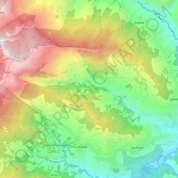
Name: Lapilang topographic map, elevation, terrain.

Location: Lapilang, Kalinchok, Dolakha, Bagmati Pradesh, Nepal (27.71145 86.03016 27.76387 86.14718)

Average elevation: 2,055 m

Minimum elevation: 895 m

Maximum elevation: 3,780 m

Gear up for your next adventure:

🥾Mountain Hiking Boots - High-traction boots for rocky terrain
Camping Groundsheet - Protect your tent from moisture and dirt
👟Trail Running Shoes - Agile footwear for fast-paced topographic exploration
🛰️Satellite Messenger - Emergency communication for areas with no cell service
🧊Portable Cooler - Keep food and drinks cold during outdoor adventures

As an Amazon Associate, this site earns from qualifying purchases at no extra cost to you.