Geolocate

Grauberg topographic map

Click on the map to display elevation.

About this map

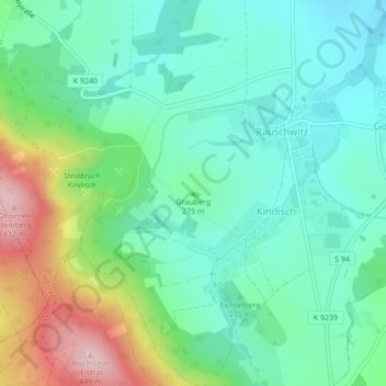
Name: Grauberg topographic map, elevation, terrain.

Location: Grauberg, Elstra, Bautzen, Sachsen, Deutschland (51.19364 14.12383 51.19374 14.12393)

Average elevation: 280 m

Minimum elevation: 217 m

Maximum elevation: 432 m

Gear up for your next adventure:

🧦Hiking Liner Socks - Thin base layer to prevent friction and blisters
🎒Backpack Rain Cover - External shield to keep your entire pack dry
🧴Insect Repellent - Protect yourself from bugs during outdoor adventures
🥾Mountain Hiking Shoes - Shoes with superior grip for mountainous terrain
🌡️Emergency Mylar Blankets - Compact thermal protection for unexpected nights outdoors

As an Amazon Associate, this site earns from qualifying purchases at no extra cost to you.