Geolocate

West District topographic map

Click on the map to display elevation.

About this map
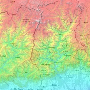
Name: West District topographic map, elevation, terrain.

Location: West District, West Sikkim District, Sikkim, 737111, India (26.63333 87.55000 28.03333 88.95000)

Average elevation: 2,636 m

Minimum elevation: 77 m

Maximum elevation: 8,489 m

Gear up for your next adventure:

🛌Insulated Sleeping Pad - Critical thermal barrier between you and the cold ground
🕯️Camping Lantern - Illuminates your entire campsite with high-efficiency LEDs
🐕Hiking Dog Pack - Let your canine companion carry their own water and food
🧦Outdoor Socks - Durable socks designed for hiking and outdoor sports
🩹Moleskin Blister Pads - Direct protection for painful foot pressure points

As an Amazon Associate, this site earns from qualifying purchases at no extra cost to you.