
Kumaon topographic map
Click on the map to display elevation.
About this map
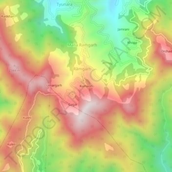
Name: Kumaon topographic map, elevation, terrain.
Location: Kumaon, Rāmgarh, Kosya Kutauli, Nainital, Uttarakhand, India (29.39830 79.53215 29.43830 79.57215)
Average elevation: 1,968 m
Minimum elevation: 1,520 m
Maximum elevation: 2,363 m