Geolocate

Banks topographic map

Click on the map to display elevation.

About this map

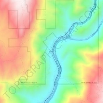
Name: Banks topographic map, elevation, terrain.

Location: Banks, Boise County, Idaho, 83602, United States (44.05884 -116.14361 44.09884 -116.10361)

Average elevation: 1,184 m

Minimum elevation: 838 m

Maximum elevation: 1,627 m

Gear up for your next adventure:

🥾Lightweight Hiking Shoes - Comfortable shoes for day hikes
💡Portable Camping Lamp - Rechargeable lamp for campsite lighting
🧥Softshell Jacket - Windproof and breathable jacket for hiking
🧢Sun Protection Cap - Breathable cap to protect from sun exposure
🔥Emergency Fire Starter - Reliable ignition source for all weather conditions

As an Amazon Associate, this site earns from qualifying purchases at no extra cost to you.