Geolocate

Old Orchard Beach topographic map

Click on the map to display elevation.

About this map
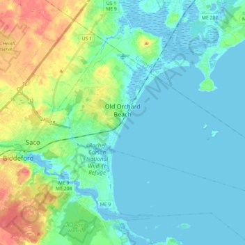
Name: Old Orchard Beach topographic map, elevation, terrain.

Location: Old Orchard Beach, York County, Maine, 04064, United States (43.46166 -70.42526 43.55372 -70.22209)

Average elevation: 14 m

Minimum elevation: -6 m

Maximum elevation: 58 m

Gear up for your next adventure:

🥾Trail Running Boots - Durable shoes designed for trail running
🥾Hiking Gaiters - Protect legs and shoes from mud, snow, and debris
🧥Softshell Jacket - Windproof and breathable jacket for hiking
🥾Hiking Shoes - Durable and comfortable shoes for trail hiking
⛺Camping Tent - Weather-resistant tents suitable for 2 to 6 people

As an Amazon Associate, this site earns from qualifying purchases at no extra cost to you.