Geolocate

Bowyer Island topographic map

Click on the map to display elevation.

About this map
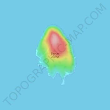
Name: Bowyer Island topographic map, elevation, terrain.

Location: Bowyer Island, Electoral Area A, Metro Vancouver Regional District, British Columbia, Canada (49.41766 -123.27681 49.43279 -123.26141)

Average elevation: 10 m

Minimum elevation: 0 m

Maximum elevation: 171 m

Other topographic maps

Click on a map to view its topography, its elevation and its terrain.

Gear up for your next adventure:

🧦Crew Hiking Socks - Comfortable socks for long-distance hikes
🪜Heavy Duty Carabiners - Multi-use clips for securing gear to your backpack
🛌Insulated Sleeping Pad - Critical thermal barrier between you and the cold ground
🥾Approach Shoes - Shoes designed for climbing approaches and rugged trails
🦌Outdoor Trail Camera - Monitor wildlife activity near your favorite spots

As an Amazon Associate, this site earns from qualifying purchases at no extra cost to you.