Geolocate

Podio Inferiore topographic map

Click on the map to display elevation.

About this map

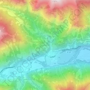
Name: Podio Inferiore topographic map, elevation, terrain.

Location: Podio Inferiore, Pratolungo, Vinadio, Cuneo, Piemont, Italy (44.29192 7.14957 44.33192 7.18957)

Average elevation: 1,284 m

Minimum elevation: 827 m

Maximum elevation: 2,067 m

Gear up for your next adventure:

🧴Insect Repellent - Protect yourself from bugs during outdoor adventures
🔭Compact Monocular - One-handed bird watching and trail spotting
🧥Thermal Layer - Insulating layer for cold outdoor conditions
🔦UV Flashlight - Detect minerals or specific insects in the dark
🥾Lightweight Hiking Boots - Boots for comfort and mobility on long hikes

As an Amazon Associate, this site earns from qualifying purchases at no extra cost to you.