Geolocate

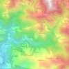
Chingad topographic map

Click on the map to display elevation.

About this map

Name: Chingad topographic map, elevation, terrain.

Location: Chingad, Surkhet, Karnali Province, Nepal (28.53159 81.74547 28.72411 81.91874)

Average elevation: 1,529 m

Minimum elevation: 530 m

Maximum elevation: 2,754 m

Other topographic maps

Click on a map to view its topography, its elevation and its terrain.

Bheri River

Nepal > Karnali Province > Surkhet > Botechaur

Average elevation: 1,112 m

Chautara

Nepal > Karnali Province > Surkhet > Birendranagar

Average elevation: 1,197 m

Gaighat

Nepal > Karnali Province > Surkhet

Average elevation: 545 m

Manikapur

Nepal > Karnali Province > Surkhet

Average elevation: 673 m

Dapcha

Nepal > Karnali Province > Surkhet

Average elevation: 1,088 m

Mulpani

Nepal > Karnali Province > Surkhet

Average elevation: 654 m

Ghari Mehelkuna

Nepal > Karnali Province > Surkhet

Average elevation: 563 m

Gear up for your next adventure:

🥾Approach Boots - Comfortable boots for hiking and climbing approaches
🥾Mountain Hiking Boots - High-traction boots for rocky terrain
🕶️Polarized Sunglasses - Protect your eyes with durable polarized lenses
🥾Waterproof Hiking Shoes - Durable shoes for wet and rugged trails
🦌Outdoor Trail Camera - Monitor wildlife activity near your favorite spots

As an Amazon Associate, this site earns from qualifying purchases at no extra cost to you.