
Thank you for supporting this site ❤️
Make a donation
Make a donation
Gear up for your next adventure:
As an Amazon Associate, this site earns from qualifying purchases at no extra cost to you.
Taşçı topographic map
Click on the map to display elevation.
Thank you for supporting this site ❤️
Make a donation
Make a donation
Gear up for your next adventure:
As an Amazon Associate, this site earns from qualifying purchases at no extra cost to you.
About this map
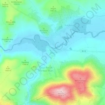
Name: Taşçı topographic map, elevation, terrain.
Location: Taşçı, Develi, Kayseri, Central Anatolia Region, Turkey (38.19448 35.77234 38.23448 35.81234)
Average elevation: 1,375 m
Minimum elevation: 1,298 m
Maximum elevation: 1,581 m
Thank you for supporting this site ❤️
Make a donation
Make a donation
Gear up for your next adventure:
As an Amazon Associate, this site earns from qualifying purchases at no extra cost to you.