Geolocate

la Guia topographic map

Click on the map to display elevation.

About this map

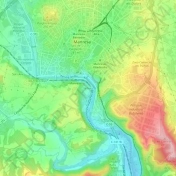
Name: la Guia topographic map, elevation, terrain.

Location: la Guia, Manresa, Bages, Barcelona, Catalonia, 08243, Spain (41.69838 1.81051 41.73838 1.85051)

Average elevation: 258 m

Minimum elevation: 181 m

Maximum elevation: 381 m

Gear up for your next adventure:

🧭GPS Outdoor Watch - Smart watch for navigation and fitness tracking in nature
🧥Thermal Fleece Jacket - Versatile insulation for changing mountain temperatures
🧴Outdoor Sunscreen - High SPF protection for high-altitude UV exposure
🥾Hiking Leggings - Comfortable leggings for outdoor activities
🧤Rechargeable Heated Gloves - Extreme warmth for Canadian winter expeditions

As an Amazon Associate, this site earns from qualifying purchases at no extra cost to you.