Geolocate

United topographic map

Click on the map to display elevation.

About this map

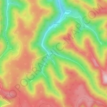
Name: United topographic map, elevation, terrain.

Location: United, Kanawha County, West Virginia, 25060, United States (37.97066 -81.44650 38.01066 -81.40650)

Average elevation: 607 m

Minimum elevation: 359 m

Maximum elevation: 823 m

Other topographic maps

Click on a map to view its topography, its elevation and its terrain.

Dunbar

United States > West Virginia > Kanawha County

Average elevation: 221 m

Gear up for your next adventure:

🪑Ultralight Camping Stool - Compact seating for rest stops during long hikes
🎒Fully Waterproof Backpack - Total protection for photography gear and electronics
🧢Outdoor Visor - Breathable visor for sunny hikes
🔋Emergency Crank Radio - Weather alerts and power without needing batteries
🧭GPS Tracker - Track your location in remote areas safely

As an Amazon Associate, this site earns from qualifying purchases at no extra cost to you.