
Thank you for supporting this site ❤️
Make a donation
Make a donation
Gear up for your next adventure:
As an Amazon Associate, this site earns from qualifying purchases at no extra cost to you.
Tortum topographic map
Click on the map to display elevation.
Thank you for supporting this site ❤️
Make a donation
Make a donation
Gear up for your next adventure:
As an Amazon Associate, this site earns from qualifying purchases at no extra cost to you.
About this map
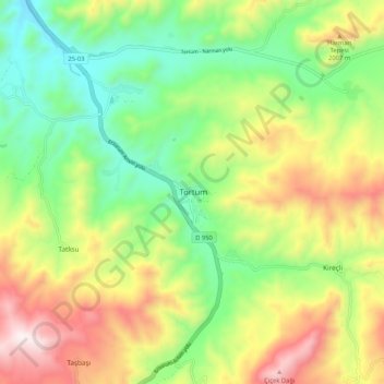
Name: Tortum topographic map, elevation, terrain.
Location: Tortum, Erzurum, Eastern Anatolia Region, Turkey (40.25708 41.51083 40.33708 41.59083)
Average elevation: 1,820 m
Minimum elevation: 1,456 m
Maximum elevation: 2,360 m
Thank you for supporting this site ❤️
Make a donation
Make a donation
Gear up for your next adventure:
As an Amazon Associate, this site earns from qualifying purchases at no extra cost to you.