
Thank you for supporting this site ❤️
Make a donation
Make a donation
Gear up for your next adventure:
As an Amazon Associate, this site earns from qualifying purchases at no extra cost to you.
Akçapınar topographic map
Click on the map to display elevation.
Thank you for supporting this site ❤️
Make a donation
Make a donation
Gear up for your next adventure:
As an Amazon Associate, this site earns from qualifying purchases at no extra cost to you.
About this map
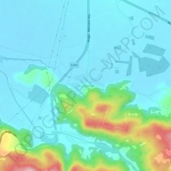
Name: Akçapınar topographic map, elevation, terrain.
Location: Akçapınar, Ula, Muğla, Aegean Region, 48660, Turkey (37.00576 28.33786 37.04576 28.37786)
Average elevation: 44 m
Minimum elevation: 0 m
Maximum elevation: 233 m
Thank you for supporting this site ❤️
Make a donation
Make a donation
Gear up for your next adventure:
As an Amazon Associate, this site earns from qualifying purchases at no extra cost to you.