
Thank you for supporting this site ❤️
Make a donation
Make a donation
Gear up for your next adventure:
As an Amazon Associate, this site earns from qualifying purchases at no extra cost to you.
Plattsburgh topographic map
Click on the map to display elevation.
Thank you for supporting this site ❤️
Make a donation
Make a donation
Gear up for your next adventure:
As an Amazon Associate, this site earns from qualifying purchases at no extra cost to you.
About this map
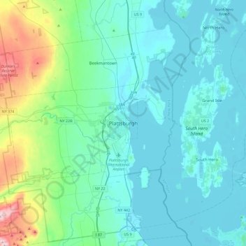
Name: Plattsburgh topographic map, elevation, terrain.
Location: Plattsburgh, Clinton County, New York, 12901, United States (44.53282 -73.61562 44.85282 -73.29562)
Average elevation: 116 m
Minimum elevation: 26 m
Maximum elevation: 636 m
Thank you for supporting this site ❤️
Make a donation
Make a donation
Gear up for your next adventure:
As an Amazon Associate, this site earns from qualifying purchases at no extra cost to you.