Geolocate

Molo topographic map

Click on the map to display elevation.

About this map

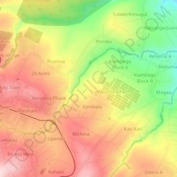
Name: Molo topographic map, elevation, terrain.

Location: Molo, Nakuru, Kenya (-0.25950 35.74242 -0.23724 35.78458)

Average elevation: 2,391 m

Minimum elevation: 2,215 m

Maximum elevation: 2,525 m

Gear up for your next adventure:

🔥Camping Stove - Portable stoves to cook outdoors with ease
🛌Insulated Sleeping Pad - Critical thermal barrier between you and the cold ground
🧥Insulated Jacket - Keep warm in cold outdoor conditions
💡LED Camping Lantern - Illuminate your campsite with long-lasting lanterns
🦶Hiking Shoe Insoles - Added support for high arches and long days on feet

As an Amazon Associate, this site earns from qualifying purchases at no extra cost to you.