Geolocate

Yuji topographic map

Click on the map to display elevation.

About this map

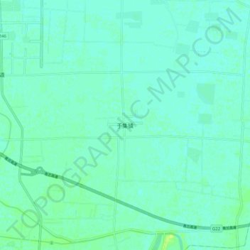
Name: Yuji topographic map, elevation, terrain.

Location: Yuji, Liaocheng, Shandong, 252000, China (36.29340 116.00572 36.37340 116.08572)

Average elevation: 37 m

Minimum elevation: 33 m

Maximum elevation: 46 m

Gear up for your next adventure:

🔋Lithium AA Batteries - Long-lasting power that performs in extreme cold
🧢Beanie Hat - Keep your head warm in cold weather
🥾Hiking Gaiters - Protect legs and shoes from mud, snow, and debris
🧥Fleece Jacket - Warm and lightweight jacket for layering
Backpacking Tent - Lightweight tent for long-distance hiking trips

As an Amazon Associate, this site earns from qualifying purchases at no extra cost to you.