Geolocate

Jacksonville topographic map

Click on the map to display elevation.

About this map

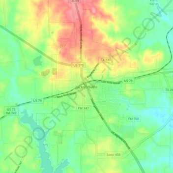
Name: Jacksonville topographic map, elevation, terrain.

Location: Jacksonville, Cherokee County, Texas, 75766, United States (31.92378 -95.31050 32.00378 -95.23050)

Average elevation: 154 m

Minimum elevation: 113 m

Maximum elevation: 222 m

Gear up for your next adventure:

Camping Coffee Maker - Brew fresh coffee anywhere on the topographic map
🧥Softshell Hiking Jacket - The perfect balance of wind protection and breathability
🚲MTB Frame Bag - Carry tools and maps directly on your bicycle frame
🧴Insect Repellent - Protect yourself from bugs during outdoor adventures
🥘Camping Cookware Set - Compact nesting pots and pans for trail cooking

As an Amazon Associate, this site earns from qualifying purchases at no extra cost to you.