Geolocate

Shahul topographic map

Click on the map to display elevation.

About this map

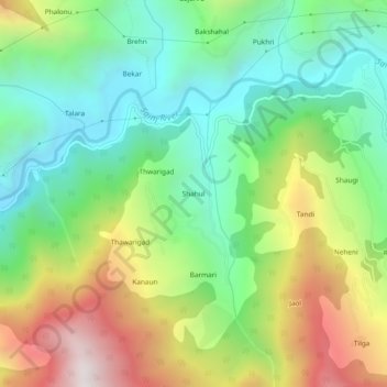
Name: Shahul topographic map, elevation, terrain.

Location: Shahul, Sainj, Kullu, Himachal Pradesh, 175134, India (31.73778 77.26043 31.77778 77.30043)

Average elevation: 1,648 m

Minimum elevation: 1,117 m

Maximum elevation: 2,557 m

Gear up for your next adventure:

🥾Waterproof Hiking Boots - Essential footwear for rugged terrain and wet Canadian trails
Family Camping Tent - Spacious tent suitable for family camping trips
🥾Trekking Poles - Adjustable trekking poles to reduce knee stress and improve stability
🥫Freeze-Dried Meals - Lightweight, high-calorie nutrition for multi-day treks
🥾Mountain Hiking Boots - High-traction boots for rocky terrain

As an Amazon Associate, this site earns from qualifying purchases at no extra cost to you.