
North Salt Lake topographic map
Interactive map
Click on the map to display elevation.
About this map
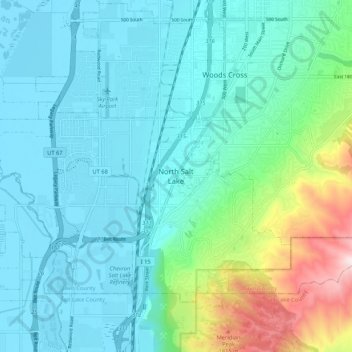
Name: North Salt Lake topographic map, elevation, terrain.
Location: North Salt Lake, Davis County, Utah, 84054, United States (40.80856 -111.94688 40.88856 -111.86688)
Average elevation: 1,422 m
Minimum elevation: 1,280 m
Maximum elevation: 2,020 m