Geolocate

Logiano topographic map

Click on the map to display elevation.

About this map

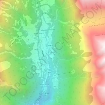
Name: Logiano topographic map, elevation, terrain.

Location: Logiano, Mesocco, Moësa, Grisons, 6563, Switzerland (46.37495 9.21709 46.41495 9.25709)

Average elevation: 1,336 m

Minimum elevation: 592 m

Maximum elevation: 2,489 m

Gear up for your next adventure:

🌡️Emergency Mylar Blankets - Compact thermal protection for unexpected nights outdoors
🥾Trekking Boots - Durable boots for long-distance trekking
🧥Thermal Fleece Jacket - Versatile insulation for changing mountain temperatures
🥾Lightweight Hiking Shoes - Comfortable shoes for day hikes
🧢Hiking Sun Hat - Wide-brimmed protection for exposed mountain ridges

As an Amazon Associate, this site earns from qualifying purchases at no extra cost to you.