
Thank you for supporting this site ❤️
Make a donation
Make a donation
Gear up for your next adventure:
As an Amazon Associate, this site earns from qualifying purchases at no extra cost to you.
Izúcar topographic map
Click on the map to display elevation.
Thank you for supporting this site ❤️
Make a donation
Make a donation
Gear up for your next adventure:
As an Amazon Associate, this site earns from qualifying purchases at no extra cost to you.
About this map
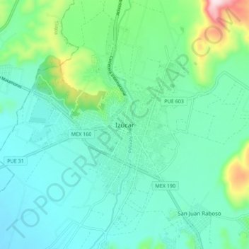
Name: Izúcar topographic map, elevation, terrain.
Location: Izúcar, Izúcar de Matamoros, Puebla, 74400, Mexico (18.56222 -98.50577 18.64222 -98.42577)
Average elevation: 1,303 m
Minimum elevation: 1,209 m
Maximum elevation: 1,667 m
Thank you for supporting this site ❤️
Make a donation
Make a donation
Gear up for your next adventure:
As an Amazon Associate, this site earns from qualifying purchases at no extra cost to you.