
Otoe County topographic map
Interactive map
Click on the map to display elevation.
About this map
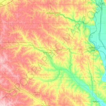
Name: Otoe County topographic map, elevation, terrain.
Location: Otoe County, Nebraska, VS (40.52211 -96.46379 40.78497 -95.70993)
Average elevation: 355 m
Minimum elevation: 275 m
Maximum elevation: 449 m
Other topographic maps
Click on a map to view its topography, its elevation and its terrain.
Nebraska City
VS > Nebraska > Nebraska City
Nebraska City, Otoe County, Nebraska, VS
Average elevation: 309 m