
Braddock Heights topographic map
Click on the map to display elevation.
Braddock Heights
Braddock Heights is located at an elevation of 950 feet (290 m) atop Braddock Mountain (as Catoctin Mountain is locally known) near the pass at Braddock Springs, so named after British General Edward Braddock and Lt. Colonel George Washington's use of the mountain pass on their way to Fort Duquesne during the French and Indian War on April 29, 1755. During the Civil War, Braddock Heights was the site of a minor cavalry battle between generals J.E.B. Stuart (CSA) and Alfred Pleasonton (USA) on September 13, 1862; it was at that time known as "Fairview Pass". One mile east of Braddock Heights, near the base of Braddock Mountain, are the older communities of Clifton and Old Braddock.
About this map
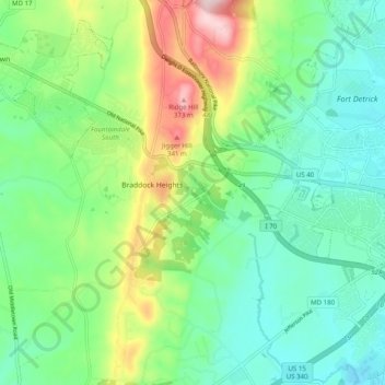
Name: Braddock Heights topographic map, elevation, terrain.
Average elevation: 179 m
Minimum elevation: 88 m
Maximum elevation: 389 m
Other topographic maps
Click on a map to view its topography, its elevation and its terrain.