Geolocate

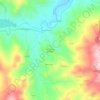
Pedaso topographic map

Click on the map to display elevation.

About this map

Name: Pedaso topographic map, elevation, terrain.

Location: Pedaso, Fermo, Marche, 63827, Italia (43.07841 13.82232 43.10332 13.84708)

Average elevation: 35 m

Minimum elevation: -2 m

Maximum elevation: 175 m

Other topographic maps

Click on a map to view its topography, its elevation and its terrain.

Marina Palmense

Italia > Marche > Fermo > Fermo > Torre di Palme

Average elevation: 40 m

Vetice

Italia > Marche > Fermo > Montefortino

Average elevation: 707 m

San Martino al Faggio

Italia > Marche > Fermo > Smerillo

Average elevation: 483 m

Montazzolino

Italia > Marche > Fermo > Montefortino

Average elevation: 624 m

Gear up for your next adventure:

🧭Orienteering Kit - Tools for map reading and navigation in the wild
🥾Durable Hiking Shoes - Long-lasting shoes for frequent hiking
🧤Insulated Winter Gloves - Heavy-duty protection for sub-zero Canadian adventures
🔭Compact Binoculars - Lightweight optics for scouting trails and wildlife
🕯️Camping Lantern - Illuminates your entire campsite with high-efficiency LEDs

As an Amazon Associate, this site earns from qualifying purchases at no extra cost to you.