
Make a donation
Gear up for your next adventure:
As an Amazon Associate, this site earns from qualifying purchases at no extra cost to you.
Rio Pao topographic map
Click on the map to display elevation.
Make a donation
Gear up for your next adventure:
As an Amazon Associate, this site earns from qualifying purchases at no extra cost to you.
About this map
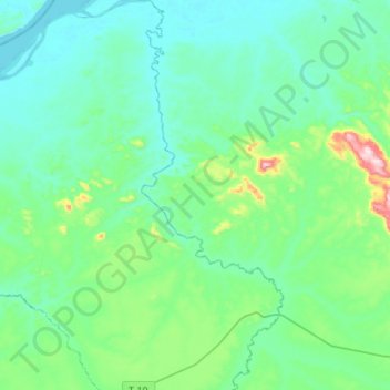
Name: Rio Pao topographic map, elevation, terrain.
Location: Rio Pao, Municipio Sucre, Estado Bolívar, Venezuela (7.46049 -64.65190 7.72815 -64.55352)
Average elevation: 90 m
Minimum elevation: 12 m
Maximum elevation: 487 m
Make a donation
Gear up for your next adventure:
As an Amazon Associate, this site earns from qualifying purchases at no extra cost to you.
Other topographic maps
Click on a map to view its topography, its elevation and its terrain.
Río Erebato
Venezuela > Estado Bolívar > Municipio Sucre > Santa María de Erebato
Average elevation: 400 m
Make a donation
Gear up for your next adventure:
As an Amazon Associate, this site earns from qualifying purchases at no extra cost to you.