
Kettenbach topographic map
Interactive map
Click on the map to display elevation.
About this map
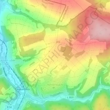
Name: Kettenbach topographic map, elevation, terrain.
Average elevation: 261 m
Minimum elevation: 169 m
Maximum elevation: 361 m
Other topographic maps
Click on a map to view its topography, its elevation and its terrain.
Kalte Herberge
Deutschland > Hessen > Rheingau-Taunus-Kreis > Oestrich-Winkel
Kalte Herberge, Oestrich-Winkel, Rheingau-Taunus-Kreis, Hessen, Deutschland
Average elevation: 518 m