Geolocate

Mills topographic map

Click on the map to display elevation.

About this map

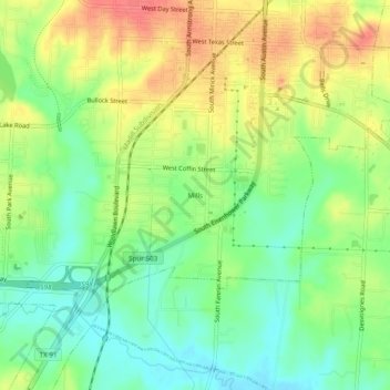
Name: Mills topographic map, elevation, terrain.

Location: Mills, Denison, Grayson County, Texas, 75021, United States (33.70955 -96.56582 33.74955 -96.52582)

Average elevation: 208 m

Minimum elevation: 180 m

Maximum elevation: 242 m

Gear up for your next adventure:

🧢Sun Hat - Wide-brim hat for sun protection
🧊Insulated Water Bottle - Keeps drinks cold in summer and prevents freezing in winter
🧥Waterproof Jacket - Lightweight rain jackets for hiking and outdoor activities
💡LED Camping Lantern - Illuminate your campsite with long-lasting lanterns
👟Trail Running Shoes - Agile footwear for fast-paced topographic exploration

As an Amazon Associate, this site earns from qualifying purchases at no extra cost to you.